Continuous 3D positioning
Absolute geographic coordinates of the submerged vehicle, updated continuously.

Positioning and remote control of underwater drones from self-propelled surface units
Project Cassiopea provides continuous three-dimensional positioning and wireless remote piloting of one or more unmanned underwater vehicles, at distances in the order of kilometres from the point of departure. The position reference is not fixed: it is a group of self-propelled surface units that follows the vehicle.
The system uses no physical link to the submerged vehicle and does not depend on fixed or pre-positioned infrastructure. It is fully transportable and can be used in any body of water: marine, lake or river.
Key points
Absolute geographic coordinates of the submerged vehicle, updated continuously.
Bidirectional link: commands to the vehicle, status and data back to the operator.
Self-propelled surface units follow it and hold the optimal geometry. Range in the order of kilometres.
Only the final stretch of the link travels underwater, whatever the distance from the operator.
Only the antennas stay above the surface: reduced detectability.
The technical problem
The navigation and remote control of unmanned aerial vehicles rest on three elements: the satellite system for positioning, the barometric sensor for altitude, and the wireless link for communication between vehicle and operator.
None of the three can be transferred directly to the underwater environment. Water completely shields the satellite signal and drastically attenuates electromagnetic signals. At any significant distance from the submerged vehicle, neither satellite positioning nor conventional wireless communication is possible.
Every operational limit that characterises the use of unmanned underwater vehicles today follows from this constraint: dependence on a cable, dependence on infrastructure installed in advance, or giving up continuous control of the vehicle.
Aerial vehicleSatellite positioning, barometric altitude and the link with the operator are all available.
Underwater vehicleWater completely shields the satellite signal and drastically attenuates electromagnetic signals.
The physical constraint of the underwater environment
 Design representation
The invention
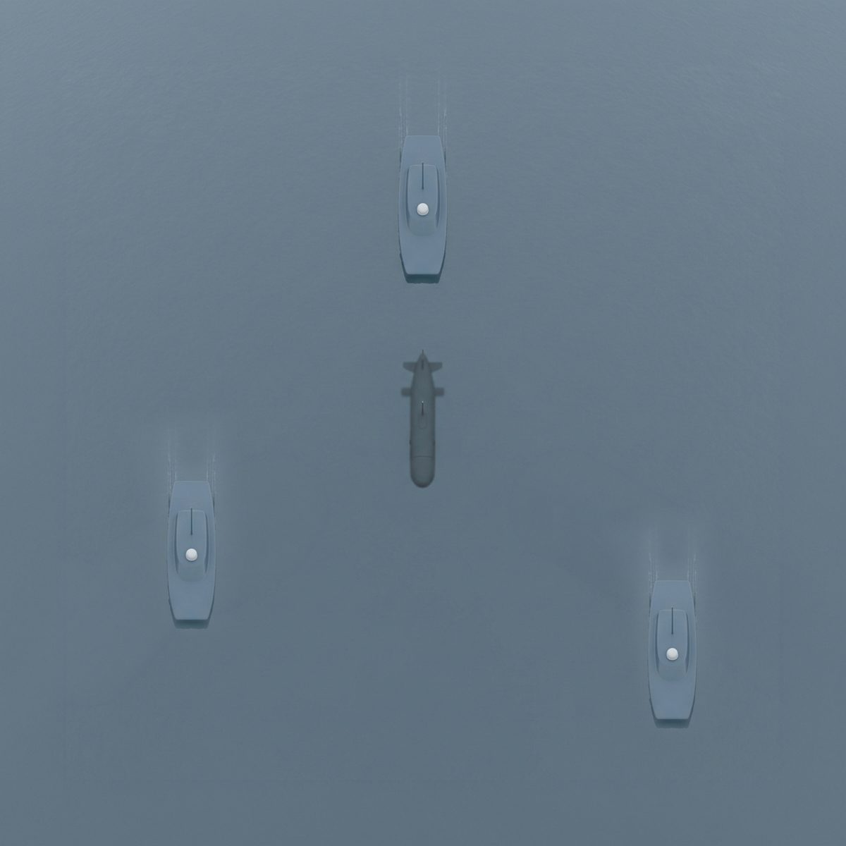
Project Cassiopea replaces the fixed reference with a mobile one. The surface units of the system are neither buoys nor infrastructure: they are self-propelled craft that navigate in the wake of the submerged vehicle, actively holding the geometric configuration best suited to locating it.
The vehicle therefore never moves away from its own reference system, because the reference system moves with it. Satellite reception and the link with the operator remain above the surface, where they are possible. Only the final leg of the link travels underwater, and that leg is held within usable limits for the whole duration of the mission, whatever distance the vehicle covers.
The operating range of the vehicle is thus not limited by the range of the underwater wireless signal relative to a fixed surface point, but only by the overall energy endurance of the surface units and of the vehicle.
Operating principle
Position of the unitsThe geographic position of each surface unit is known at every instant through the satellite system.
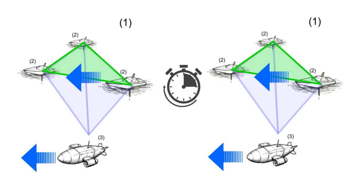
TrilaterationThe arrival times t1, t2, t3 of the vehicle signal at units A, B and C, combined with the known positions of those units at the same instant, give the three-dimensional position of the vehicle in absolute geographic coordinates.
Trilateration principle
 Design representation
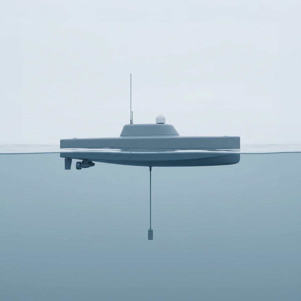
Each surface unit carries one or more external antennas, placed above the surface of the water. The antennas receive the satellite signal, so the geographic position of every unit is known at every instant, and they support bidirectional wireless communication with the operator control unit. The link with the operator may use any available technology depending on operating distance and environmental conditions, including direct radio transmission in VHF, UHF or equivalent bands and satellite links.
Each surface unit also carries at least one submerged antenna, placed below the surface of the water, for bidirectional underwater wireless communication with the vehicle. Transmission may use any technology suited to propagation in water: mainly acoustic over significant distances, of another nature — optical or inductive — over short distances.
The vehicle transmits an underwater wireless signal received simultaneously by all the surface units. The arrival times of the signal at each unit, combined with the known positions of those units at the same instant, allow the three-dimensional position of the vehicle to be computed by trilateration with respect to an absolute geographic reference system, continuously.
In the opposite direction the surface units transmit to the vehicle the commands issued by the operator, and receive its status data and the data it has acquired. The distance from the operator is covered by the radio or satellite link of the surface units; only the stretch between the units and the vehicle travels underwater. The delay of the underwater communication therefore depends on the distance between the units and the vehicle, not on the distance the vehicle has covered from the point of departure.
Distinctive feature of the system
The feature that sets Project Cassiopea apart from known solutions is the active coordinated movement of the surface units following the submerged vehicle.
The units move so as to keep the vehicle substantially inside, or close to, the polygon they form on the surface, and to hold the geometric quality parameter of the trilateration within a preset value. That parameter is known in satellite and acoustic navigation as geometric dilution of precision (GDOP) and depends on how the reference units are arranged with respect to the point being located.
Favourable geometryVehicle inside the polygon and units well distributed: the geometric quality parameter stays within the preset value.
Degraded geometryUnits nearly aligned and vehicle outside the polygon: the parameter worsens and with it the accuracy of the computed position.
Geometric quality of the trilateration
The system is configured to act on the position of the surface units according to one or more operating thresholds. When one or more of them is exceeded, it reconfigures the position of one or more units to restore geometric and energy conditions favourable to the positioning and control of the vehicle.
The geometric quality parameter of the trilateration exceeds the preset limit value.
The vehicle departs from the centroid of the polygon formed by the surface units beyond the preset limit distance.
The distance between the vehicle and one of the surface units approaches the usable range limit of the underwater wireless signal in use.
The remaining endurance of one of the surface units falls below the preset threshold, with consequent compensation by the other units.
Operating trim
The surface units can operate on the surface or in a semi-submerged configuration, navigating below the surface of the water with only the external antennas emerging.
The system remains fully operational: the external antennas keep receiving the satellite signal and supporting the link with the control unit, and the submerged antenna keeps communicating with the vehicle. All that changes is what stays above the surface of the water.
None of the hull emerges. Only the external antennas remain above the surface.
Running below the surface, the unit is less exposed to wind and wave motion.

Architecture
Main configurationTrilateration among the three units for the coordinates in the horizontal plane, on-board depth gauge for the depth coordinate.
Alternative configurationThree-dimensional position obtained by trilateration alone thanks to the overdetermination of the system. Depth gauge optional, as a redundancy element.
The two system configurations
The three units all operate on the surface. Trilateration among them provides the geographic coordinates of the vehicle in the horizontal plane; the depth gauge installed on board provides the depth coordinate. Complete three-dimensional positioning is thus obtained.
With four or more units the three-dimensional positioning of the vehicle is obtainable by trilateration alone, thanks to the overdetermination of the system, even without a depth gauge on board. In this configuration the depth gauge may still be fitted as a redundancy element: it allows three-dimensional positioning to be maintained even if contact with one of the surface units is lost during operations.
Modes
Besides the coordinated movement mode, the system allows an independent movement mode for the surface units, in which each moves according to specific operational needs without formation constraints. The position of each unit remains known at every instant through the satellite system and usable for trilateration purposes.
The system allows the simultaneous control of one or more underwater vehicles, each located by trilateration with respect to the same surface units, with coordinated sharing of the communication between each vehicle and the units.
Piloting is preferentially by continuous wireless remote control, through the bidirectional exchange of commands and data relayed by the surface units. The system also allows, as an accessory, semi-autonomous or pre-programmed navigation modes, in which the vehicle follows predefined tracks or missions with the possibility of correction by the operator during the mission.
Operational scenario
The four phases of the mission
The surface units and the underwater vehicle are put in the water together from the point of departure, from the shore or from a support craft.
The system moves as a whole towards the area of operations. The surface units accompany the vehicle for the whole duration of the mission, continuously maintaining its positioning and control link.
At the end of the mission the system returns together.
Alternatively the surface units return on their own, while the vehicle remains in the area of operations.
Operational implications
The availability of a continuous three-dimensional position in absolute coordinates, of a continuous bidirectional link and of an operating range in the order of kilometres with no cable constraint is the enabling condition for the operational use of an unmanned underwater vehicle. On that basis Project Cassiopea is conceived to support the following classes of use.

The bidirectional link transmits to the operator the data acquired by the vehicle during the mission and allows its conduct to be altered during the mission on the basis of what is observed, without waiting for the vehicle to be recovered.
Continuous piloting and a position known in absolute geographic coordinates make it possible to bring the vehicle onto a determined point and to work there under the direct control of the operator.
The simultaneous control of several vehicles on the same surface units makes it possible to distribute the mission across several craft while keeping a single positioning reference and a single operator.
Continuous positioning over a wide area, autonomous reconfiguration of the formation and the ability to operate in semi-submerged trim with reduced detectability make the system usable for persistent surveillance and for intervention under the direct control of the operator, in a defensive or proactive posture.
In every class of use the distinguishing trait remains the same: the operator keeps control of the vehicle and knowledge of its position for the whole duration of the mission, whatever distance is covered.
Composition
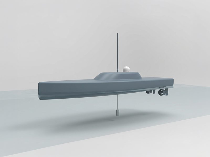
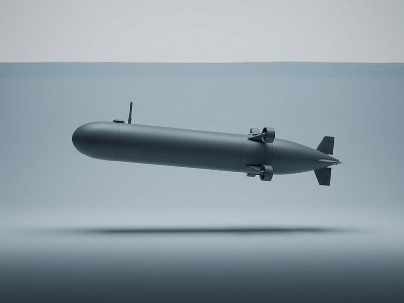
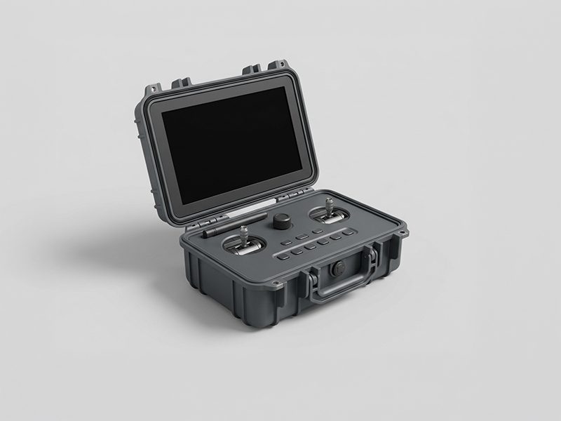
The invention is a system made up of a plurality of mobile surface units, at least one underwater vehicle and a control unit at the operator. The three elements are conceived as parts of the same whole.
 Design representation
 Design representation
 Design representation
State of the art
The solutions currently used for the positioning and control of unmanned underwater vehicles fall into five categories. Each solves part of the problem by imposing a constraint on the rest.
Physical link by optical fibre or electrical cable between the vehicle and the surface control unit. It guarantees reliable communication with no signal limitations.
Operating range and freedom of manoeuvre are constrained by the length of the cable. To this is added the risk of snagging.
Fixed acoustic transmitters, pre-positioned on the bottom or moored in fixed positions in the body of water. They allow greater freedom of movement than a cable.
It requires infrastructure installed in advance, not transportable and not quickly reusable in a different context. Once the vehicle leaves the range of the transmitters, contact is irretrievably lost.
An array of acoustic transducers installed on a single surface unit, typically a vessel or a fixed buoy. It requires no infrastructure on the bottom.
Positioning error grows with distance and with the observation angle. The system depends on a single surface unit, which constrains the vehicle to remain within a limited distance from it.
The vehicle estimates its own position autonomously by means of accelerometers and gyroscopes, without external references. It requires no infrastructure at all.
Position error is cumulative and grows over time. Positioning becomes progressively unreliable on long-duration or long-range missions.
Floating platforms, drifting or fitted with propulsion, which receive the satellite signal for their own positioning and communicate acoustically with the submerged vehicle, acting as relay nodes towards the control station.
The platforms do not move actively in the service of the vehicle, following its movement: they operate in free drift or in positions set by the operator. When the vehicle moves significantly the positioning geometry degrades and the accuracy of the computed position worsens, up to loss of contact. Piloting is mostly entrusted to a pre-programmed mission loaded before launch, with limited scope for correction: continuous, bidirectional remote control is not provided for.
None of the known solutions provides continuous wireless remote control of an underwater vehicle with continuous three-dimensional positioning and virtually unlimited operating range, fully transportable and independent of fixed or pre-positioned infrastructure.
Industrial property
The system is the subject of a patent application.
Contact
Project Cassiopea is open to technical discussion with industrial and institutional parties interested in the development of the system. Full documentation and detailed matters are handled directly and confidentially.
milpro@divesystem.com